For decades, fans of the Inheritance Cycle have relied on the map created by Christopher Paolini in 2000 as a visual aid for navigating the land of Alagaësia. Now, in celebration of Eragon‘s 20th anniversary, a new map was developed to update and expand the continent. (The map will be included in the upcoming Illustrated Edition of Eragon, which you can learn more about here.)

We scoured the map for unknown, hidden, and new locations, and compiled an all-encompassing list of every discovery, organized by region, accompanied by detailed descriptions for each landmark. You’ll find that collection below!

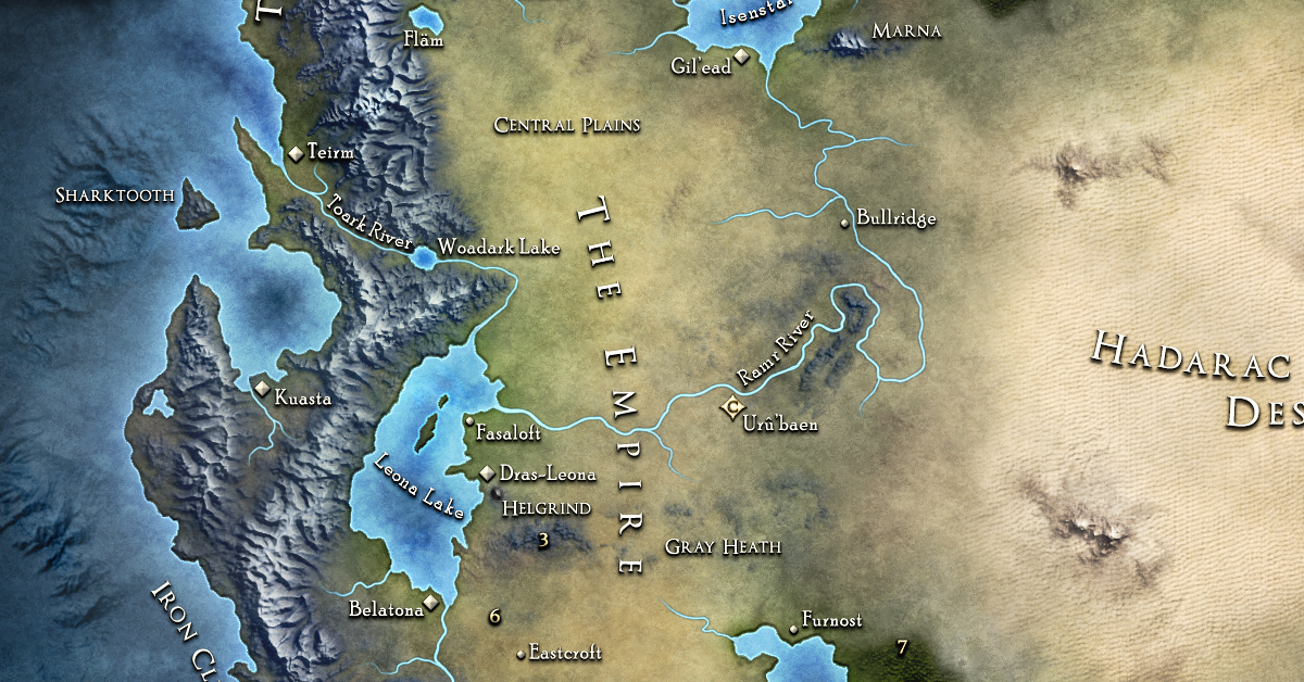
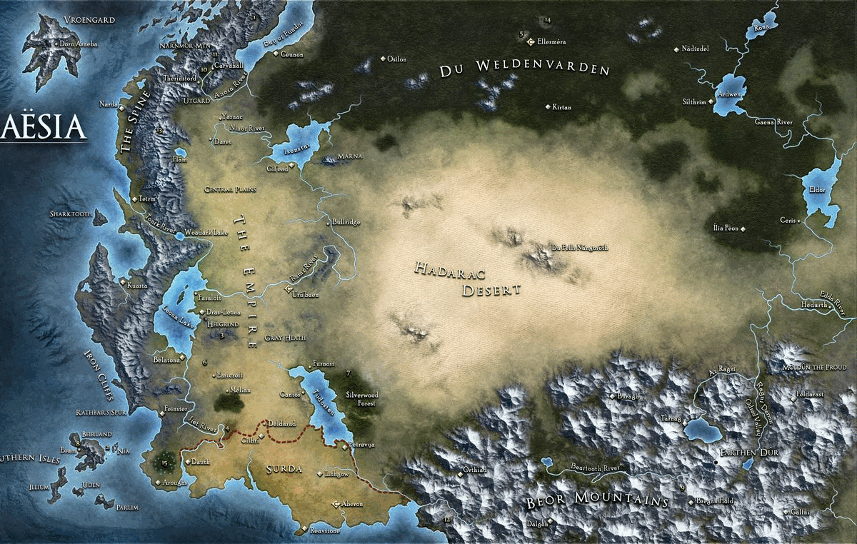
But first, let’s take a peek at the map itself:
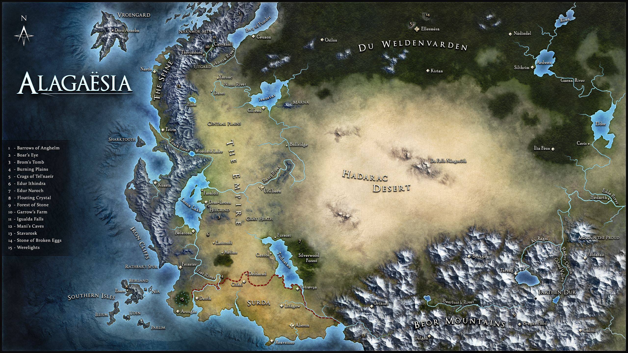
We also created an animated side-by-side comparison for readers interested in how the old and new maps differ:
.Now, let’s dive in to the new locations and landmarks:
.
 Eastcroft
A small village between Dras-Leona and Eastcroft where Eragon met Arya on his return to Surda.

Silverwood Forest
Located on the eastern rim of Tudosten Lake, this large forest was the birthplace of Oromis and a resting spot for Eragon, Saphira, and Orik as they traveled to reach the Varden before the Battle of the Burning Planes.
Fasaloft
A small village located northwest of Dras-Lenoa overlooking Leona Lake, visited by Brom and Eragon on their journey to Dras-Leona.
Gray Heath
Also known as Mírnathor by the elves and Werghadn by the dwarves, this area of open land east of Helgrind was where Eragon and Sloan traveled after departing Helgrind. This was the starting location of Sloan’s long journey to Ellesméra.
Burning Plains
A land left smoldering after a battle between Dragon Riders and the Forsworn during the Fall of the Riders. Both the Battle of the Burning Planes (between the Empire and the Varden) and the Battle of the Jiet River (between Eragon/Saphira and Murtagh/Thorn) occurred here.
Edur Ithindra
An ancient elven tower outpost where Tenga was living when Eragon discovered him during his travels. (Tenga fled this location before Nasuada’s spellcasters could find him after Galbatorix’s demise.)

Edur Naroch
An elven tower where Glaedr and Oromis were attacked and captured by the Forsworn.
Bay of Fundor
A large area of water believed to be connected to the sea, named after the dragon Fundor, who killed a Nidwhal in the bay. Ceunon is located along its eastern shore.
 Iron Cliffs
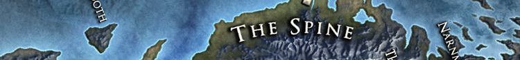
A range of cliffs along the southernmost part of The Spine.
Rathbar’s Spur
The southern tip of The Spine.
Narnmor Mountain (north of Carvahall)
The mountain which Igulada Falls flows from.

Stavarosk
Location of the legendary Battle of Stavarosk between Urgals, led by war chief Tulkhqa, and Imperial soldiers, resulting in the obliteration of half of Galbatorix’s army.
Barrows of Anghelm
Located northeast of Carvahall, the Barrows are the resting place of the only Urgal king, Kulkarvek.
 Du Fells Nángoröth
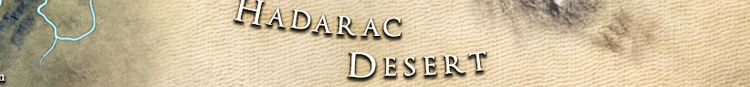
Also known as the Blasted Mountains, this land formation located in the center of the Hadarac Desert was the ancestral home of the dragons and a safe haven for their Eldunarí.
 Boar’s Eye
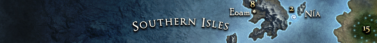
A massive maelstrom located off the southwest coast of Alagaësia between Beirland and Nía islands. The Boar’s Eye is infamous for destroying any ships unfortunate enough to venture near. The Carvahall residents aboard the Dragon Wing successfully braved the Boar’s Eye while fleeing Empire ships on their way to Surda.
Floating Crystal
A source of powerful wild magic found in Eoam, a settlement on the largest island in the Southern Isles, Beirland, off the southwest coast of Alagaësia.
 Crags of Tal’naeir
These two leagues long and thousand-feet-high cliffs were home to Oromis and Glaedr and the location where Eragon and Saphira trained during their stay with the elves.
Stone of Broken Eggs
This rock formation was home to wild dragons for many years, including during their war with the elves. This was the location of the tragic Battle of Broken Egg and Scattered Nest, when elves ambushed and killed the dragons and destroyed many of their eggs.
Rivers – Various
In eastern Alagaësia, a number of rivers have expanded to include various unnamed tributaries (river offshoots), including Ragni Darmn (Odred Valley, Beor Mountains) Edda River (which now flows off the eastern edge of the map), a new offshoot of Gaena River, and two offshoots from Ardwen lake in Du Weldenvarden, one of which now connects to Röna lake.
 Odred Valley
A valley split by the Ragni Darmn in the northeast part of the Beor Mountains which opens to Az Ragni and Moldûn the Proud.
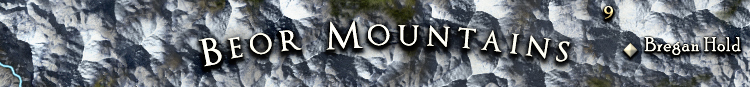
Bregan Hold
Home of the Dûrgrimst Ingeitum, this dwarf city is located south of the Beartooth River in the Beor Mountains
Mani’s Caves
Caverns in the Beor Mountains containing a wild magic dream well rumored to cause strange dreams, premonitions, and glimpses into alternate history.
Moldûn the Proud
The northernmost mountain in the Beor Mountains.
Forest of Stone
Also known as Az Knurldrâthn by the dwarves, this location contains a forest of ancient petrified trees which some believe were created by the god of stone, Helzvog. Others believe the petrified trees were placed there by the god Gûntera during the creation of Alagaësia.
Ragni Darmn
A river running through Odred Valley in the northeastern part of the Beor Mountains.

Pre-order: Amazon | Barnes & Noble | Books-A-Million


